|
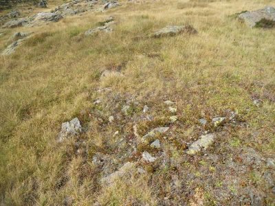
|
IBÓN DE CULIVILLAS 2 tumulua
| Tipo |
Tumulua. |
| Zone |
Valle de TENA. |
| Descubrimiento |
L. Millán San Emeterio (05-07-1988) |
Location |
· Alt.: 830 m.
· WGS84 42.778133 lat., -0.402391 long.
· ED50 30T X.712600, Y.4739660
· Ubicación exacta (~25m) |
| Autenticidad |
Zalantzazkoa. |
| Cerca |
IBÓN DE CULIVILLAS 1 tumulua, CULIVILLAS SUR harrespila, CULIVILLAS harrespila, CORONA DE LOS FARALLONES harrespila, BARRANCO CULIVILLAS 3 harrespila, BARRANCO CULIVILLAS harrespila, BARRANCO CULIVILLAS zutarria, BARRANCO DE LOS CAMPOS DE TROYA harrespila, FARALLONES harrespila, PEÑA BLANCA zutarria, PEÑA BLANCA 4-5 harrespila, PEÑA BLANCA 2 harrespila, PEÑA BLANCA tumulua, PUNTA DE LA GARGANTA tumulua, PEÑA BLANCA 3 harrespila, OS FABALLONES tumulua, BARRANCO CAMPOS DE TROYA 4 harrespila, CABAÑA DE LA GLERA 5 harrespila, PEÑA BLANCA COTA harrespila, CABAÑA DE LA GLERA 3-4 harrespila, CABAÑA DE LA GLERA 1-2 harrespila. |
|
|
  |
 ibón de culivillas 2
©irundarra
Fuente: Nafarroako Karta Arkeologikoa (Hilharriak taldea).
Imágenes
 ***
 ***
|

|

